There’s a Hidden Continent Lurking Beneath Europe
Lost continent discovered under Europe
The phrase ‘lost continent’ always makes me wonder, how exactly does one ‘lose’ a whole continent? Like, where did it go? Scientists have spent nearly 10 years piecing this together: a frame-by-frame breakdown of 240 million years of history to give us a picture of a lost continent they’re calling Greater Adria. And, it turns out, it’s not truly gone...it’s underneath us. Well, mostly underneath southern Europe. But let’s go back to the beginning. About 240 million years ago, this Greenland-sized land mass was part of the Gondwana supercontinent, wedged in with its North African and European counterparts.
 |
| There’s a Hidden Continent Lurking Beneath Europe |
About 20 million years later, it decided to make a break for it and started separating from Africa, and in another 40 million years it became a truly independent continent. We don’t know a whole lot about what it was like, but researchers are pretty sure it was largely submerged, maybe with some bits sticking up here and there. This is because they’ve found that for most of history, almost all of it was covered in marine sediments...until about 100 million years ago, that is, when it started to go ‘crunch’.
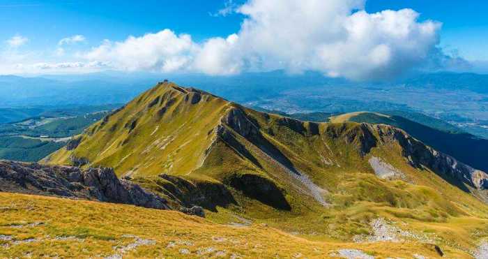
On its journey towards self-discovery, floating about on the Earth’s surface thanks to continental drift, Greater Adria encountered what is now southern Europe. When tectonic plates encounter each other, one plate has to go under the other, which is called subduction. This process can be relatively short, where one plate doesn’t go very far under the other, or one continent can be totally subsumed by the other. This process of continental collision often smooshes the plates up to form mountains, like the Himalayas. In the case of Greater Adria, it meets southern Europe and it shatters into pieces and is sucked under its opposing continental plate, where it gets officially ‘lost’ in Earth’s syrupy mantle. But as it goes, its top layer gets scraped off and shoved up, instead of down, forming part of the Apennine mountains in central Italy.
This is how we get marine fossils on top of mountains—those marine sediment layers on the top of a continent like Greater Adria getting scraped off during subduction and carried upward by mountain formation. Colliding plates are a messy and chaotic business, and these relics of a lost continent, mostly chunks of limestone, are sprinkled all over the Mediterranean.
This means the continental remnants are spread out across borders. Geoscience agencies tend to have developed their own logic and ways of talking about these kinds of geological processes, so piecing all of it together to form a whole picture was challenging in ways even beyond the science. These hurdles were partly why this data took so long to amass, but also just because of the sheer number of pieces of the continent there were to puzzle together.
This means the continental remnants are spread out across borders. Geoscience agencies tend to have developed their own logic and ways of talking about these kinds of geological processes, so piecing all of it together to form a whole picture was challenging in ways even beyond the science. These hurdles were partly why this data took so long to amass, but also just because of the sheer number of pieces of the continent there were to puzzle together.
Each sample of rock from this continent—size, shape, composition—is its own data point, and from there the researchers could reverse-engineer the path of the continent as it met its demise. Because even though what we’re talking about sounds quite cataclysmic and violent, all of this motion is happening over tens of millions of years. When the researchers say they think that Greater Adria spun counterclockwise as it subducted down into the depths, we’re talking about 3-4 centimeters per year rate of change in position.
And there’s other exciting work that’s excavating evidence of lost continents too! This same research team has also used seismic waves to pulse the mantle to generate an image, a little bit like a medical imaging scan, to see what’s hanging out in the Earth’s mantle. They are creating what they like to call ‘an atlas of the underworld’, or the first complete mapping of subducted tectonic plates that have ended up in the Earth’s mantle. Using these methods, they’ve seen evidence of Greater Adria up to 1500 km below the surface of the Earth. Deep stuff.


No comments